
TAHAMÍ GEOPARK PROJECT
Geology · Culture · Community
1.5 billion years of history in the Central Mountain Range of Colombia


In this geopark, the first in Antioquia, the way in which geology and the population are intertwined will be shown and highlighted.
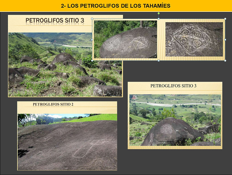
The presence of numerous gold and silver mineralizations, related to the Antioquia Batholith, attracted populations from pre-Hispanic times, as demonstrated by the petroglyphs created by the Tahamíes and the countless stories of tombs with indigenous treasures, although they were not the only tribe present, they left indelible marks.


The colonization of this region in search of gold has marked its culture for more than 400 years and persists to this day, with small-scale mining by the barequeros in the rivers and industrial-scale mining such as the Gramalote mine.
During the colonial era, slavery was imposed for mining, resulting in a mix of Indigenous, Spanish, and African races in this area. African rituals, dances, and influence continue to be an important part of the region's traditions.
Every corner of the Tahamí Geopark is an open book that tells the story of the Earth and its evolution throughout geological time and the customs of its inhabitants.


With enthusiasm and commitment, the representatives of the Tourism Boards of the Northeast, Middle Magdalena, and Eastern Antioquia will unite in a bold endeavor: to serve as the administrative body for the proposed creation of the Tahamí Geopark. This project's main objective is to unite municipalities that share a rich cultural heritage and are home to incredible geodiversity and biodiversity.
The Tahamí Geopark aims to enhance the value of this region and give it international recognition, highlighting its unique potential in both its natural (biotic and abiotic) and cultural aspects. Our fundamental pillars will be geoprotection, geoeducation, and geotourism, with the firm purpose of preserving and promoting this heritage for present and future generations.


We recognize that the path to creating this geopark will be a gradual process, but we are convinced that with the active participation of the entire local community and the support of departmental and local authorities, we will achieve our goal. Together, we are committed to working tirelessly to make this shared dream a reality and ensure sustainable and harmonious development for our region.
The project was submitted in April 2024 to the Colombian Geological Survey, which is legally responsible in Colombia for receiving proposals for future Geoparks. It has also been sent to the board of directors of the Latin American and Caribbean Geoparks Network (GEOLAC) for their support.
We have the support of a geology research group from the National University of Medellín, led by Professor Luis Hernán Sánchez Arredondo, Albeiro Rendón, and Adiela Martinez. We also have the support of the Colombian Geological Society, Antioquia chapter, led by Mariana Vásquez.

THE TAHAMIES
The Tahamíes, an indigenous group from Colombia belonging to the Chibchan language family, inhabited the eastern region of the Department of Antioquia, between the Magdalena River to the east and the Porce and Nechí Rivers to the west. Their territory encompassed the present-day municipalities of Medellín, El Retiro, El Carmen de Viboral, Rionegro, Remedios, Marinilla, Segovia, Amalfi, El Peñol, La Ceja, Puerto Nare, Guarne, La Pintada, Cisneros, Yalí, Yolombó, Zaragoza, Vegachí, and Maceo.
The Spanish ventured into Tahamí territories in the second half of the 16th century in search of gold and river routes connecting the Cauca, Porce, and Nechí rivers with the Magdalena. This led to cultural subjugation and intermingling with the Spanish and with Africans, especially those from West Africa, brought by the former as slaves to extract gold and replace the indigenous population. The invasion resulted in the loss of the language, many customs, and the imposition of the Catholic religion, which, however, could not eliminate many local beliefs associated with the worship of the jungle and the jaguar.
